LILY POND PARK, DEER ISLE
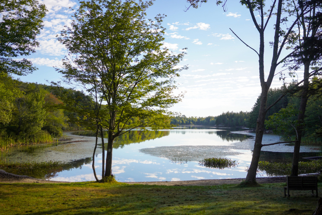
Gravel paths through an old farmstead lead to Lily Pond beach which provides a beautiful area to recreate in all seasons.
ACTIVITIES TO ENJOY AT LILY POND PARK:
- Swimming
- Picnicking
- Paddling
- Hiking
- Fishing
- Ice Skating
1.0 MILE TRAIL SYSTEM:
Traditional Rating: EASY
Accessibility Rating: EASY+ – MODERATE
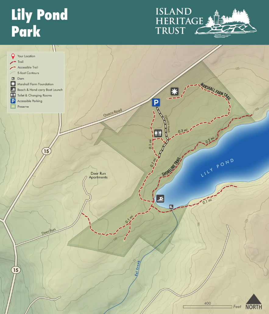
The Deer Run Trail runs from the parking area to the pond’s beach through old apple trees and a mixed forest. Gentle up hill and downhill trail, both are wheelchair and stroller accessible, and allowing for easy carry-in small boat access.
EXPLORE THE PRESERVE:
Enjoy well-maintained stone paths that lead from the parking areas to the pond, making for moderate accessibility for those with mobility challenges, plus additional trails on either side of the pond. The walk from parking lot to the shorefront is .2 miles. Benches are available for seating.
The public, freshwater access is great for swimming, fishing, and non-motorized watercraft. Plus, a Bath house with a pit toilet is available during the Summer season.
PLEASE FOLLOW THESE GUIDELINES:
- Day Use Only – no camping or overnight parking
- Pets allowed under voice control
- No fires allowed
- Foot traffic only
- Leave it better than you found it
- Respect the privacy of our neighbors
DIRECTIONS TO THE PRESERVE
From the Deer Isle Causeway, drive South on Route 15 for approximately 3.5 miles. Turn left onto Quaco Road. The entrance to Lily Pond Park will be on your right in .1 mile.
VISIT THE LILY POND TREE NURSERY & POLLINATOR GARDEN
In 2023, IHT began to create a small native tree nursery in the Lily Pond meadow to propagate woody plants for future projects at IHT preserves and other island lands. The foundation of this initiative was supported by USDA’s Project Canopy Grant and serves to provide resources for a healthy and resilient forest around Lily Pond Park.
This area also functions as an educational opportunity for local schools, island residents, and visitors. In the wake of a changing climate, our forests are experiencing wetter springs, sustained droughts, more frequent and intense winds, and the migration of invasive pests. Our hope is to provide visitors with a glimpse of what a healthy and sustainable forest may look like in the future along the coast of Maine, by being in relationship and reciprocity with the land. Volunteers have been hard at work to make this a special and inviting space for all!
To learn more, click here to view a 2024 Stewardship Presentation about the Forest Health at Lily Pond Park and on Deer Isle!
STORY OF PUBLIC ACCESS
Before the arrival of colonists who claimed these lands for themselves, the Indigenous people likely utilized Lily Pond for abundant eel runs in the outlet brook just south of the beach.
Starting in 1768, the 200 acres of land that ran from where the Mill Dam in Deer Isle village is today back along the north shore of the pond to a point north of the west end of Torrey’s Pond, passed through several different hands. At one point, it was called Marshall’s Pond. The beach property eventually came into the ownership of Ed Pickering, grandfather of Ted Pickering, maternal grandfather of Randall Haskell who sold it to IHT. The neighboring property, later acquired by IHT, was owned by Frank Pickering.
HISTORY OF LILY POND PARK
The pond has seen a variety of uses over time. Besides powering mills along the outlet brook, it has long served recreational purposes: for swimming (including swimming lessons), canoeing, fishing (the state stocks the pond), ice skating and ice boating. Horses were raced until 1926, when cars with chains on the wheels replaced them. On Sunday afternoons, hundreds of spectators would watch the competition. Ice harvesting may have taken place, as it did on Torrey’s Pond, although this is not certain.
Lily Pond is now classified by the state as a “Great Pond” (20 acres or more). Dams constructed along the outlet brook served to power various mills.
The Deer Isle fire department has used the pond to practice marine rescues and has seen the pond as a source of water. Currently, the outlet brook feeds a reservoir on the edge of Deer Isle village. As well, several homes once relied on the pond for water, among them the 1812 house and those of the Spoffords and Edwin (“Neddie”) Haskell. The town has more recently thought of the pond as a potential source of water for the village. It is also valued for its contribution to the surrounding water table.
Another use of the pond has been as a landing site for aircraft: on the ice in winter, on the water in summer. This led to an incident in 1981, when a float plane landed on the pond. The pilot, John H. Reid of Massachusetts, flew his 1975 Cessna with a passenger to visit friends on the island. In the late afternoon, they prepared for takeoff from the eastern end of the pond. Heading west, the plane lifted a few feet off the water, but could not sustain it and came back down. Skidding along the water, it was headed directly at a crowd of about 20 people enjoying themselves on the beach. The crowd scattered, and at the last minute, the pilot veered off, crashing into a tree about 15 feet away. No one was hurt in the crowd, but the plane burst into flame and was a total loss. Fortunately, one of the onlookers, a student from Bowdoin College, was able to pull the two occupants from the wreck. Though badly burned, they survived the incident.


