SCOTT’S LANDING PRESERVE, DEER ISLE
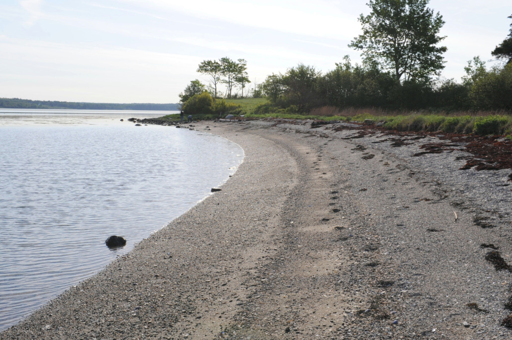
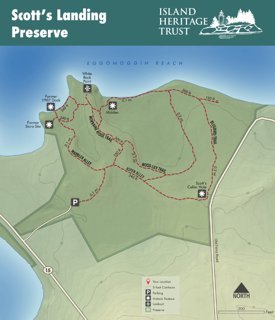
Located on the northeast side of Deer Isle, this 24-acre property is an old farm with open meadows and wooded dells. Enjoy 1.5 miles of trails through varied bird habitat to a shingle beach on Eggemoggin Reach.
ACTIVITIES TO ENJOY AT SCOTT’S LANDING:
- Bird Watching
- Butterfly Watching
- Photography
- Views of Eggemoggin Reach and the Deer Isle Bridge
1.0 MILE TRAIL SYSTEM:
Traditional Rating: EASY-MODERATE
Accessibility Rating: HARD
The trails range in difficulty with paths perfect for young families through the woods, fields, and beaches.
EXPLORE THE PRESERVE
The open nature of the land’s maintained fields creates easy access to the shingle beach and native blueberry fields. Don’t miss the aspen grove towards the old farm site! Visiting in the early morning, this can be one of the island’s best birding spots.
PLEASE FOLLOW THESE GUIDELINES:
- Day Use Only – no camping or overnight parking
- Please leave your pets at home – respect wildlife or fragile wildlife habitat. Click here to find dog-friendly preserves.
- No open fires
- Foot traffic only
- Leave it better than you found it
- Carry out trash – yours and any you find
- Respect the privacy of our neighbors.
DIRECTIONS TO THE PRESERVE
From the Deer Isle bridge, drive south on Route 15 for 1.8 miles, crossing the Causeway to the preserve entrance on the left, opposite of Causeway Beach.
GET TO KNOW THE FLORA & FAUNA
With Ecologist, Dr. Ken Crowell, & Naturalist, Marnie Reed Crowell:
“There are many natural communities at Scott’s Landing: the beach and inter-tidal zone, brackish marsh, shrub-marsh, alder thicket, the spruce-fir forest, aspen-birch woodland, and old field. Each of these habitats has unique residents!
Forest & Field:
Along the trails you will find alternate-leaved dogwood; hawthorn, called thorn-apple; Virginia roses; and wild-raisin, a shiny-leaved viburnum pictured here with the day-flying moth called Spear-marked Black, very common in some summers.
In the taller bushes and trees you might see tiny warblers that always arrive here at the end of May. First to arrive are the Yellow-rumped Warblers. By mid-May our most common warbler will be the Black-throated Green Warbler.
Speckled Alders are common here; that tells you that the habitat is damp and the soil is poorly drained. Among the spring wild flowers is trout lily, uncommon on Deer Isle and an indicator of rich soil.
The wild cherries, sumac, Virginia rose and other shrubs and young trees here are prime habitat for Chestnut-sided warblers and Common Yellowthroat. Come here in April at about 8 PM, just after sunset when the first stars come out, and you can watch the displays of Woodcock. In the bushes you are likely to hear Song Sparrows. They are short-distance migrants, and are among the first birds to come back here in spring. Blackbirds and Hermit Thrushes are also among these early arrivals. Catbirds sing often in this habitat, and you might hear the beautiful songs of thrushes in the early spring evenings.
On a warm day in any month you might see Mourning Cloak Butterflies, black ones with a yellow edge, named for Victorian mourning tradition. Introduced Cabbage White butterflies are now our most common species, among the first and last of the season. Tiny pale blue butterflies are Azures. They will be seen when the blooms are on the shadbush, named for shad, an anadromous fish that used to run in great numbers up our rivers from the ocean in spring to lay their eggs in the fresh water. Later you will see wild cherries and then the old apple trees from the farm come into bloom and Parula warblers are likely. When the lilacs around the Island bloom, you will see Tiger Swallowtails on them.
Beach and Intertidal Areas:
Rocks along the shore are usually covered with blue-green and green algae, which are very slippery when wet! Below the high tide line, look for seaweeds like smooth cord weed, knotted wrack, and common rockweed. Lower in the tide zone, look for pink crustose coralline algae that produces a thick calcium layer on rocks and shells. This is not a true coral but is a plant!
As you walk along the beach, you may find shells of blue mussels, soft-shell clams, common periwinkles (snails), and common slipper shells. In intertidal area, you will find northern rock barnacles attached to rocks and other shells. You might even find a limpet firmly attached to a rock!
Tracks in the mudflats may be made by periwinkles of one of many species of worms. Peek under seaweed and rocks to find rock crabs, green crabs, and even a small eel-like fish called a rock gunnel.
Overhead you may see an Osprey or Bald Eagle. Both nest on or near Carney Island on the other side of Causeway Beach. Common waterbirds include Herring Gull, Ring-billed Gull, Double-crested Cormorant, and in winter Common Loon and Eider ducks.”
Check Out the FULL Virtual Guided Walk through Scott’s Landing Preserve
GEOLOGY OF SCOTT’S LANDING:
The rolling hills of Scott’s Landing were left by the continental ice sheet that retreated from Deer Isle about 16,000 years ago. During pauses in the retreat, moraines – ridges of sand, silt and clay in which rocks are suspended like plums in a pudding – were formed along the edge of the glacier. At this time, the weight of the ice depressed the land below sea level, and as the ice retreated further, marine clay was draped across the moraines.
As the land rose above sea level, about 12,000 years ago, wave action washed the clay into low areas between moraines, where it remains today. Clay drains poorly, so these areas of Scott’s Landing are now wetlands. All bedrock, called the Ellsworth Schist. White Rock Point is a classic outcrop of this schist; its whitish color is just the outer weathered surface of the rock.
The sediments that form the Ellsworth Schist were deposited about 500 million years ago. Look for the intense folding of bands in this rock. The folds developed about 400 million years ago, deep within the earth’s crust, during metamorphism that accompanied a mountain building episode!
STORY OF PUBLIC ACCESS
These 24 acres were purchased in 2006 with the assistance of Maine Coast Heritage Trust. This land is owned and managed by Island Heritage Trust.
INDIGENOUS HISTORY OF SCOTT’S LANDING:
“When the first Europeans began their intrusion into the Penobscot Bay region 400 years ago, it was inhabited by people who called themselves Etchemins, meaning “real human beings” as opposed to animals, monsters, and other people. Their ancestors had been living in the region for some thousands of years before the arrival of the newcomers from across the sea, who the Etchemins called by a word meaning “Who is that?”
Scott’s Landing lies adjacent to the place called K’chistimokan’gan meaning “The Great Fish Weir” (Eckstorm 1941:205). The Passamaquoddy, who speak a modern version of the old Etchemin language, today know it as Kei Sihtom Kankanok with the same meaning (Soctomah 2004). This is the break between Deer Isle and Little Deer Isle, where the causeway is today. Before the causeway’s construction, it was an important fish passage, and here Indians built weirs (Eckstorm 1941:205). They probably also speared flounder here, as did later English – speaking residents up into the twentieth century. Clamming, too, was an important activity as shells are plentiful at the 11 known shell mound sites in the vicinity, including one at Scott’s Landing preserve.”
– Excerpt from A Short History of Scott’s Landing by William A. Haviland
“The shell mound at Scott’s Landing Preserve is part of a vast array of sites spanning the coast of “Maine,” demonstrating an enduring indigenous presence in the region that goes back to when the islands first emerged from the receding ocean waters ~8,000 years ago. Wabanaki people relied upon the extensive marine resources found here. They hunted, gathered, and lived in celebration of this ancient relationship throughout the year, with most gatherings happening during summer. This shell mound demonstrates 3,000 years of such connection, and is threatened by erosion and rising ocean levels.
Upon European contact, Wabanaki people made treaties with the colonists to ensure that future generations could continue to access the abundant resources that had sustained their ancestors for hundreds of generations. However, the colonists did not honor these treaties, and indigenous people were forced from their coastal territories through warfare and European diseases to which they had no immunity. It was no longer safe to be here, and survivors went inland, subjugated to a reservation system.
In modern times, Wabanaki people- descendants of those who lived here before colonization- still need coastal access.
Conversations about coastal land return for Penobscots began in the 1970s as part of the Land Claims Settlement between the State of Maine and Wabanaki Nations, but nothing came to fruition. Several Wabanaki-led organizations have recently been working together to spread awareness and advocate for land return. This ongoing activism is part of a broader movement across North America, reuniting indigenous people with their beloved homeland.”
– Ann Pollard Ranco, Cultural Consultant, Penobscot Storyteller
COLONIAL HISTORY OF SCOTT’S LANDING:
Scott’s Landing is where William Eaton established his homestead in 1762. A ferry was established in 1792 that served as the island’s main link to the mainland. This operated from a site a short distance east of Scott’s Bar, where the causeway is now. In 1807, the Town of Deer Isle voted $80.00 to build ferry ways here on “Scott’s Beach”, to be 75 feet long 20 feet wide, and 9 feet high at the end, of lumber with stone ballast. The lumber has long since rotted away, but the stone ballast can still be seen near the point where the northwest boundary of the IHT property comes to the shore. An earthen foundation for George Richardson’s store (brother-in-law of the third ferryman) just up the bank from the landing may also be seen.
Besides functioning as a transportation link to the mainland, the Scott’s Landing property was continuously farmed well into the 20th century. Today all that remains on the IHT property is the milk house, a barn foundation, and the old hayfield including a diked salt marsh near the shore. With its clear vista out over the Reach, this field provides one with a glimpse of what the island once looked like, before its many farms were abandoned and their open acres reverted to the woodlands that have come to cover the coastline.


