Visit a Preserve
Island Heritage Trust’s free and public preserves invite you to spend time with coastal forests, sandy beaches, and granite outcroppings. These protected places are here for you to enjoy thanks to the generosity of thousands of donors. Thank you for sharing these spaces responsibly and with care!
General Use Guidelines
Island Heritage Trust – General Use Policies
Engage with the land with care and respect!
- Day use only. No camping.
- Respect the wildlife. On islands, at Crockett Cove Woods, Barred Island and Scott’s Landing please leave pets at home. Dogs on leash are permitted at Settlement Quarry, Tennis Preserve, Shore Acres (May 1-Sept 30). Dogs on leash or under owner’s control are permitted at Causeway Beach, Reach Beach, and Shore Acres (Oct 1-April 30).
- Trails are designed for foot traffic; no bicycles or horses, please.
- Open fires are dangerous. Use cook stoves instead.
- Be a “Leave No Trace” visitor: Carry out all rubbish – your own and any you find.
- We recommend a maximum group size of 12, with small groups of 6 or fewer most preferable. Groups larger than 12, please contact IHT for visitor coordination.
- Be a “Leave No Trace” visitor: Please carry out all solid human waste and toilet paper; island soils are too fragile and shallow to bury it. Solid human waste left on the soil surface is a health hazard to humans and wildlife.
- Leave what you find as it is (such as rocks, shells, sticks, mosses and other plants).
- No motorized vehicle of any sort are permitted, except by emergency vehicles, and for property management purposes.
- Hunting with care is permitted, in season. During hunting season, all visitors should wear blaze orange.
- Clamming and fishing are permitted.
- If you’re interested in volunteering, please contact the IHT office. For permissions or questions, contact the IHT office.
THANK YOU FOR HELPING US PROTECT THIS LAND!
Where Can I Bring My Dog?
Island Heritage Trust – Dog Policy
Places Where Dogs Are Welcome – On Leash
- Church Land Preserve (May 1 – Sept 30)
- Crystal Cove
- Holt Mill Pond (Town of Stonington)
- Lily Pond Park
- Lisa Tolman Wotton Nature Preserve (May 1 – Sept 30)
- Mariner’s Memorial Park
- Settlement Quarry (May 1 – Sept 30)
- Shore Acres (May 1 – Sept 30)
- Tennis Preserve (Dept. Conservation, State of Maine)
Places Where Dogs Are Welcome – Under Voice Control or On Leash
- Causeway Beach
- Carrying Place Preserve
- Church Land Preserve (Oct 1 – April 30)
- Lisa Tolman Wotton Nature Preserve (Oct 1 – April 30)
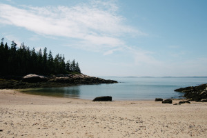
- Reach Beach
- Settlement Quarry (Oct 1 – April 30)
- Shore Acres (Oct 1 – April 30)
Nature Preserves Where Dogs Should Be Left Home
- Barred Island Preserve (The Nature Conservancy)
- Crockett Cove Woods (The Nature Conservancy)
- Scott’s Landing (to protect ground nesting birds)
- Wreck, Round and Millet Islands
Which Preserves Are the Most Accessible?
Lily Pond Park, Pine Hill Preserve, and Settlement Quarry Preserve have Easy Accessibility trail options! Learn more about each below.
Is Hunting Allowed on IHT Properties?
Yes, within the safety limits to protect non-hunting walkers and the proximity to houses. We encourage ALL Hikers to wear BLAZE ORANGE during hunting season (OCT-DEC).
Can I Use a Metal Detector?
Metal Detectors may NOT be used without written IHT permission (by filing a Research Permit – email adrenga@islandheritagetrust.org) on IHT’s inland Preserves or above the high tide line of Preserves with marine shorelines. The use with permit needs to have scientific or scholarly intent. All holes created through this activity in connection with the Research Permit must be filled. No recreational use is permitted above the high tide line or on rocky shores. Recreational use is permitted on sandy beaches below the high tide line. The rationale for this policy is that the digging (which is the common result of metal detector use) endangers and/or disturbs plants, animals, archaeological and historical remains and the holes are unsightly and are a safety hazard.
DEER ISLE


STONINGTON


OUTER ISLANDS
Mark Island
No Trail. Kayak landing only.
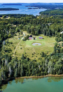
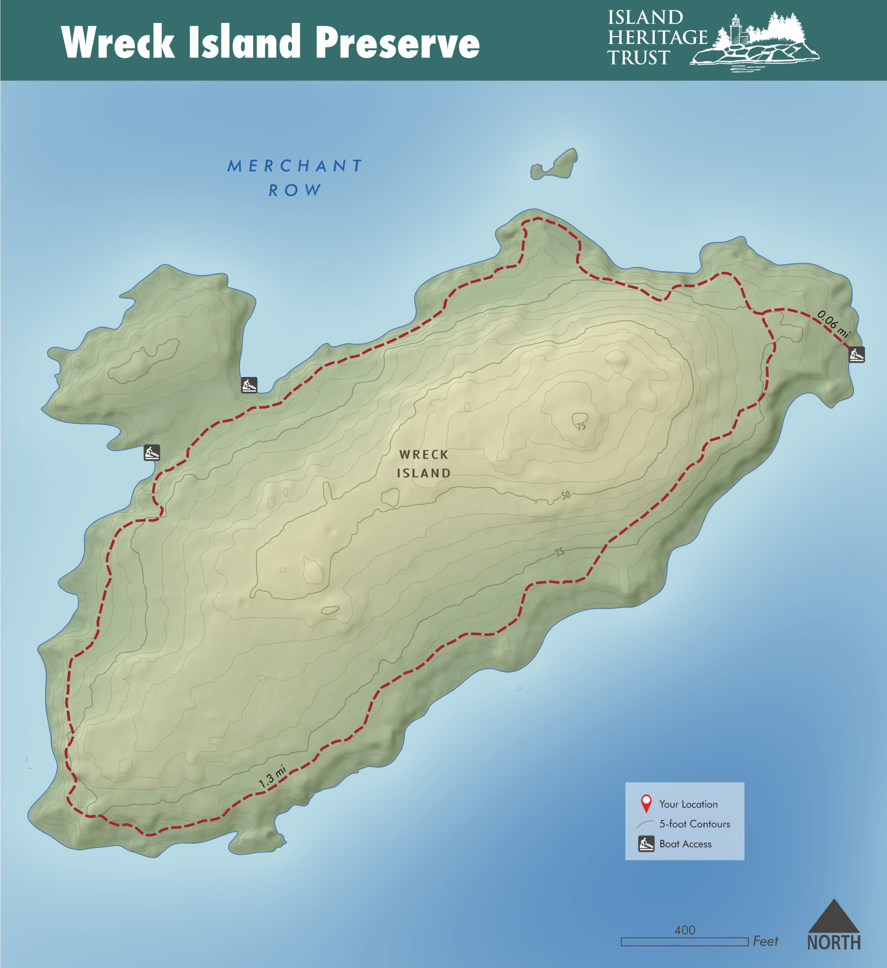
Wreck Island
Hiking Trail. Kayak and skiff landing.
Wreck Island is a 60-acre island with open meadows, pocket beaches, wooded areas, and an unmarked trail up the center of the island. The best landing is a beach at the east end of the island, accessible at any tide and not prone to winds.
We received the island from the Nature Conservancy in 1997. It was originally known as Bear Island in the 1700s, and became Barter Island in the 1800s, named after the families living on it. The origin of its current name is unclear.
Round Island
Hiking Trail. Kayak and skiff landing.
IHT received Round Island from the Nature Conservancy in 1997. The best access is on the east side – opposite McGlathery. For kayakers, the southeast beach provides a good landing spot. There is a sheltered deep-water anchorage between Wreck and McGlathery.
Whig Island
No Trail. Kayak landing only.
Located in the eastern end of the protected waterway of Long Cove. Used by deer, otter, and nesting songbirds. During the summer months, Great Blue Herons often rest and feed in the protected north side cove. Extensive tide flats surround the island at low tide, making the island inaccessible during the lower half of the tide cycle. Visitors should plan accordingly. The easiest landing is the eastern end of the island.
Whig Island was on the Native American canoe route between Castine and the other islands, as a convenient stopping place. The shell mound on the south shore confirms that it was used by Indigenous peoples.
Millet Island
No Trail. Kayak landing only.
Millet is located to the west of Saddleback Island and the east of Spruce Island in Merchant Row. The best access is on the northwest side, where there is a small beach.
The interior of the island is densely wooded with no trails. Please protect fragile plants along the shore and stick to the sand and granite ledges that ring the island.
Local Ornithologist, Margaret Hudley willed Millet Island to The Nature Conservancy, who then transferred it to IHT in 1997 as a nature preserve.
Polypod Island
Hiking Trail. Kayak access.
IHT acquired Polypod in 1999, to protect the ecological and recreational values of the island. A cove on the southeast shore of the island provides a good option for landing. Ledges on the south point provide a good platform for taking in the sights and sounds of Brays Narrows and Inner Harbor.
Sheep Island (LDI)
No Trail. Kayak landing only.
Sheep Island (Stinson Neck)
No Trail. Kayak landing only with tidal mudflats.
Seven acres of meadow and relatively open spruce forest, with a small Hub Island off to the northeast which is barred at low tide. A newly developed campsite is on the eastern shore of the main island, just upland from a small pocket beach which provides a good landing at high tide. Eagles have nested on the island on and off throughout the years. If you see eagle activity, please do not go ashore.
Bradbury Island
No trail. Kayak landing only.
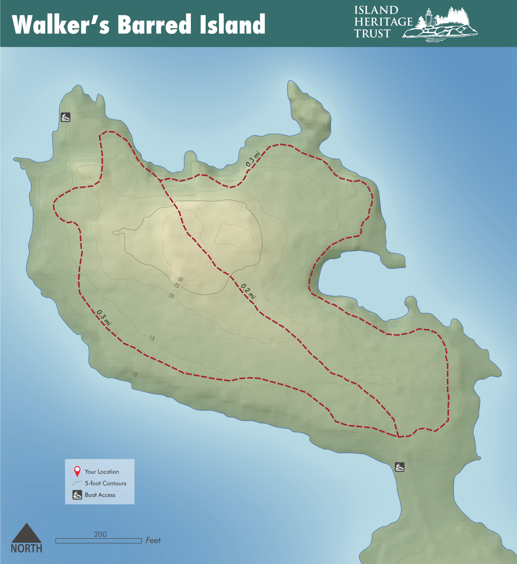
Walker’s Barred Island
Hiking Trail. Kayak landing only with tidal mudflats.
The best landing is at the north end of the island, which also provides access to the perimeter trail. Note that the area around the island flats out at low tide, so visitors should time their visits accordingly.
Carney Island
No Trail. Kayak Access.

Island Heritage Trust is a community-based, non-profit land trust contributing to the well-being of the island community by conserving its distinctive landscape and natural resources, maintaining public access to valued trails, shoreline and islands, and by providing educational programming for all ages.